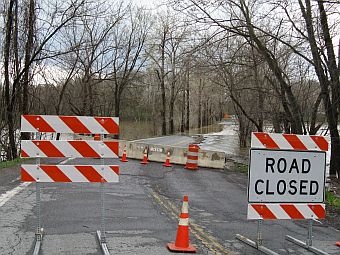
 (Host) The floodwaters in Lake Champlain have slowly decreased over the past 24 hours, but forecasters say rainfall could push the lake back up again to a new record.
This morning the gauge in Burlington is measuring 102.7 feet above sea level. But one to two inches of rain is in the forecast. National Weather Service Meteorologist Brooke Taber says he expects minor flooding on area rivers and streams.
(Taber) We do expect the lake levels on Lake Champlain to go down through the rest of today, and then as we put rain on most of the river basin through northern New York, and also Vermont, the lake level will once again rise, probably starting tonight and into tomorrow and through the rest of the week.
(Host) Taber says Lake Champlain could reach a new record of 102.9 to 103 feet. That’s three feet above flood stage.
Lake Champlain’s coverage area has expanded, but it’s difficult to tell by how much. And Taber says that large surface area means it takes a long time for floodwaters to drain northward.
(Taber) We just haven’t had an extended period of dry weather, so the continued rainfall and the associated run-off will continue to keep the Lake Champlain at record floods until further notice.
(Host) Last week’s flooding was caused by a tropical system that included high temperatures, heavy rainfall and snowmelt. This week’s weather system will be cooler, so snowmelt is not likely to contribute to flooding.